How to Open a GPX File on iPhone, Android, PC and Google Maps
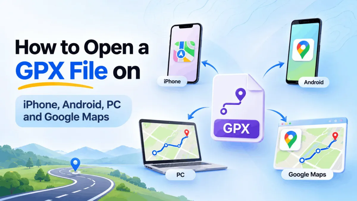
A friend sends you a trail or a road trip route as a .gpx file, you tap it, and your phone just stares back at you. That happens a lot, because phones don’t come with a built-in GPX viewer. The good news is that opening one takes a couple of minutes once you know which app to use.
This guide shows you how to open a GPX file on iPhone, Android, Windows and Mac, and how to get a GPX file into Google Maps and Google Earth. If you’d like to know what’s actually inside the file first, our guide on what a GPX file is explains the format.
How do you open a GPX file? The quick answer
You open a GPX file with an app that reads GPS data, then the route shows up as a line on a map. Which app works best depends on your device and what you want to do with the route.
| Device or app | How to open the GPX file | Free? | What you get |
|---|---|---|---|
| iPhone | Import it into Route Recorder | Yes, importing is free | The route on a map on your phone |
| Android | Import it into Route Recorder | Yes, importing is free | The route on a map on your phone |
| Windows or Mac | Open it in Google Earth Pro, or view the raw text in any text editor | Yes | A 3D map view, or the file’s code |
| Google Maps | Import it into Google My Maps on a computer | Yes | A shareable map you can view in Google Maps |
| Google Earth (web) | Convert it to KML first, then import | Yes | The route over satellite images |
The phone option is the fastest for most people. The computer options are handy when you want to plan a trip on a bigger screen or share the map with a group.
How to open a GPX file on iPhone
Your iPhone can save a GPX file to the Files app, but it won’t draw the route on a map by itself, and Apple Maps can’t import one. To see the route, you need a GPS app that reads GPX files. Route Recorder imports GPX, KML and GeoJSON files for free, so it’s an easy pick.
Step 1: Save the GPX file to your iPhone
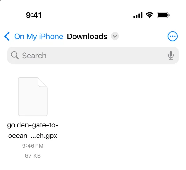
First, get the file onto your phone. Where it lands depends on how it was sent to you:
- From an email or a chat, tap the attachment, tap the share button, then choose Save to Files.
- From a website, tap the download link, and Safari puts it in the Downloads folder in Files.
- From a Mac nearby, send it with AirDrop and save it to Files.
Step 2: Import the file into Route Recorder
- Install Route Recorder for iPhone if you haven’t already.
- Open the app and tap the menu.
- Tap Import / Export.
- Pick your GPX file from the Files app.
- Open the imported route to view it on the map.
Importing is free on every plan, so you can look over the route before you leave instead of squinting at a list of coordinates.
Can you open a GPX file without an app?
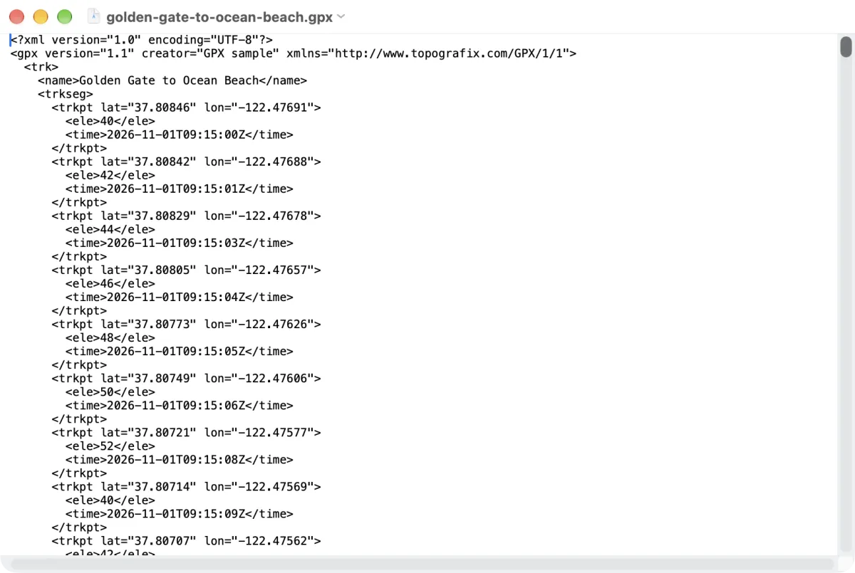
Sort of. If you open the file in a text viewer, you’ll see the raw code with all the latitude and longitude numbers. That’s fine if you just want to check the file’s name or date, but you won’t get a map out of it. For the actual route, you’ll still need an app.
How to open a GPX file on Android
Android phones can store a GPX file, but there’s no built-in viewer for it, and the Google Maps app can’t open one directly. A GPS app fixes that in a minute or two. With Route Recorder, the steps are almost the same as on iPhone.
- Download the GPX file. Most browsers and email apps save it to the Downloads folder.
- Install Route Recorder for Android from Google Play.
- Open the app, tap the menu, then tap Import / Export.
- Browse to the Downloads folder and pick the GPX file.
- Open the imported route to view the GPX file on the map.
If you tap a GPX file in your file manager and nothing happens, or your phone asks which app to use, that’s normal. Android just doesn’t know the file type yet. Importing from inside the app gets around it every time.
Open KML and GeoJSON files the same way
The same import works for KML and GeoJSON files, so you don’t need a separate app or a converter for each format. That’s handy when one friend shares a KML from Google Earth and another sends a GPX from a GPS watch.
How to view a GPX file on Windows or Mac
On a computer, you’ve got three ways to view a GPX file. Google Earth Pro shows the route on a 3D map, Google My Maps puts it on a regular Google map, and a text editor shows the raw data. Google Earth Pro is the quickest if you just want to see the line.
| Option | Works on | Best for |
|---|---|---|
| Google Earth Pro | Windows and Mac | Seeing the route over satellite images and hills in 3D |
| Google My Maps | Any web browser | Sharing the route and viewing it later in Google Maps |
| Text editor (Notepad or TextEdit) | Windows and Mac | Checking the file’s name, date or points |
View a GPX file in a text editor
Right-click the file and open it with Notepad on Windows or TextEdit on Mac. You’ll see plain XML text, with a lat and lon number for every point. It won’t draw a map, but it’s a quick way to check that the file isn’t empty or broken before you import it somewhere else.
What about online GPX viewers?
You’ll find plenty of free online GPX file viewers that draw the route in your browser. They’re fine for a quick look. Just keep in mind that you’re uploading the file to someone else’s website, and a track of where you drove can show your home or work address. For a private route, opening it on your own phone or in Google Earth Pro is the safer bet.
How to put a GPX file into Google Maps
The Google Maps app has no button for importing a GPX file. Google’s way around this is My Maps, a free tool that accepts GPX files along with KML, KMZ, CSV and spreadsheets (Google My Maps Help). You do the import on a computer, and then the map is saved to your Google account.
Import a GPX file into Google My Maps
- Go to mymaps.google.com on a computer and sign in with your Google account.
- Click Create a new map, or open a map you already have.
- In the map legend on the left, click Add layer and give the layer a name.
- Under the new layer, click Import.
- Upload your GPX file, then click Select.
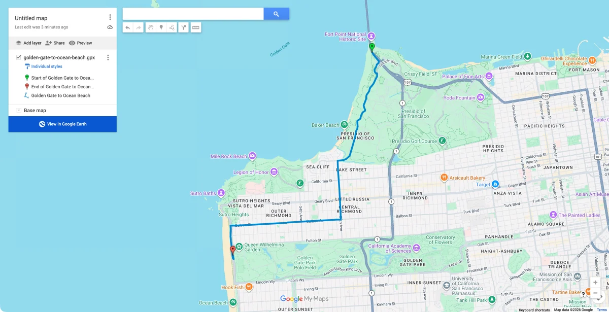
The route shows up as a line on the map, and any waypoints in the file appear as pins. You can rename the map, change the line color, and share it with friends the same way you’d share a Google Doc.
Limits to know before you import
According to Google My Maps Help, My Maps takes GPX files up to 40 MB, and a file can’t have more than 2,000 rows. Most short hikes and day drives fit with room to spare. A very long track can go over, though, so you may need to split a multi-day trip into one file per day.
View the GPX route in Google Maps on your phone
Once the map is saved, you can open it on your phone from the same Google account and see the route on top of the regular Google map. It’s view-only, so Google Maps won’t give you turn-by-turn directions along the imported line.
One more thing: Google Maps can’t make a GPX file of a drive you’ve already taken. If that’s what you’re after, our guide on how to record your driving route shows how to capture the real path as you drive.
How to open a GPX file in Google Earth
This one trips people up, because Google Earth comes in two versions and only one of them opens GPX files directly. Google Earth Pro, the free desktop app, reads GPX files as they are. Google Earth in a web browser imports KML, KMZ, GeoJSON, Shapefile and CSV files, but not GPX, so a GPX file has to be converted first (Google Earth Help).
| Version | Opens GPX directly? | What to do |
|---|---|---|
| Google Earth Pro (Windows and Mac) | Yes | Use File > Open and pick the GPS file type |
| Google Earth (web browser) | No | Convert the GPX file to KML, then import it |
Open a GPX file in Google Earth Pro
- Open Google Earth Pro and go to File > Open.
- In the file type list, choose Gps (.gpx, .loc, .mps).
- Find your GPX file, select it and click Open.
- In the GPS Data Import box, keep Create KML Tracks checked and click OK.
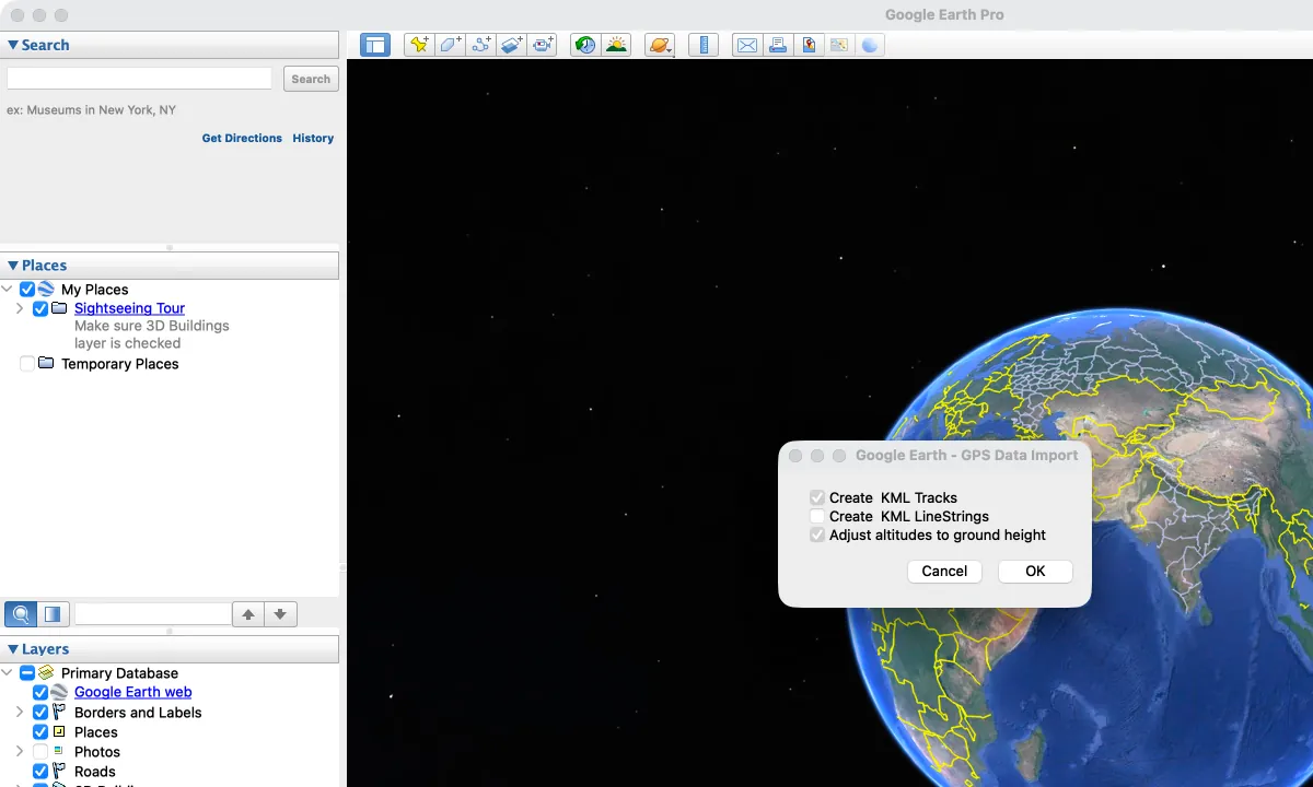
The route then shows up on the map and in the Places panel on the left (Google Earth Outreach). To keep it for next time, save it to My Places.
Open a GPX file in Google Earth on the web
Google Earth on the web won’t accept a GPX file, so you’ll need a KML version first. If the route came from Route Recorder, you can skip the converter and export the trip as KML straight from the app with Premium. Then, in Google Earth on the web:
- Click New, then Import file.
- Choose your KML file from your computer or Google Drive.
- Select Import as a data layer and wait for it to load.
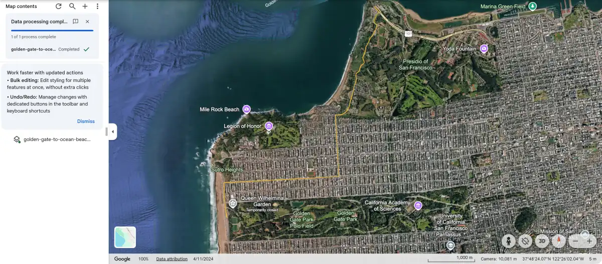
The route then shows up over satellite images, and you can tilt the view to see the hills and valleys along the way.
GPX file won’t open? Try these fixes
Most GPX files open on the first try. When one doesn’t, it’s usually down to the app you picked or how the file was saved, and the fix tends to be quick.
| What happens | Likely reason | Fix |
|---|---|---|
| Your phone says it can’t open the file | No app on the phone is set up to read GPX | Open the file from inside a GPS app such as Route Recorder instead of tapping it in Files |
| You see a page of code instead of a map | The file opened in a text or code viewer | Import it into a map app, Google Earth Pro or My Maps |
| The file ends in .xml or .txt | It was renamed during the download | Rename the ending back to .gpx, then import it again |
| Google Earth on the web won’t take it | The web version doesn’t import GPX | Use Google Earth Pro, or convert the file to KML first |
| My Maps shows an error | The file is over 40 MB or has more than 2,000 rows | Split the route into smaller files, such as one per day |
| The map opens, but no route shows up | The file only has waypoints, or it’s empty | Look for pins instead of a line, or check the file in a text editor |
If none of these work, ask the person who sent it to export the file again. A download that stopped halfway can leave a GPX file broken, and a fresh copy usually solves it.
Conclusion: the easiest way to open a GPX file
Opening a GPX file comes down to picking an app that reads GPS data. On iPhone and Android, import it into Route Recorder for free and the route shows up on the map in a minute or two. On a computer, Google Earth Pro opens it directly, and Google My Maps is how you get a GPX file into Google Maps.
Want GPX files of your own trips, too? Route Recorder records your drives and hikes, and with Premium you can export them as GPX or KML to share or open anywhere. Download it for iPhone or Android and open your first GPX file today.


FAQs about opening GPX files
1. What program opens a GPX file?
On a phone, a GPS app like Route Recorder opens GPX files for free. On a computer, Google Earth Pro opens them directly, and Google My Maps imports them in a web browser.
2. How do I open a GPX file on my iPhone?
Save the file to the Files app, then open Route Recorder, tap the menu, choose Import / Export and pick the file.
3. Can Google Maps open GPX files?
Not in the Google Maps app itself. Import the GPX file into Google My Maps on a computer, and you can then view that map in Google Maps on your phone.
4. Can Apple Maps open a GPX file?
No, Apple Maps doesn’t import GPX files. Use a GPS app that does, such as Route Recorder.
5. How do I open a GPX file in Google Earth?
In Google Earth Pro, go to File > Open and set the file type to GPS. Google Earth on the web needs the route as a KML file first.
6. Do I have to pay to open a GPX file?
No. Importing in Route Recorder is free, and Google Earth Pro and My Maps are free too.
7. Why won’t my GPX file open?
The usual reasons are an app that can’t read GPX, a file renamed to .xml or .txt, or a file that’s too big for My Maps. The fixes table above covers each one.
8. How do I share a GPX route with someone?
Send the .gpx file by email or chat, or import it into My Maps and share the map link. The other person can then open it on their own phone or computer.